Moorland, Heath and Mountains
 Moorland, Heath and Mountains
Although the birds that inhabit the moorland are relatively sparse compared to the
numbers found in the lower lying pastures and wetlands, visits to these areas from late
spring to early autumn can be rewarding. Most heather clad areas hold Red Grouse, but
these are elusive unless accidently flushed. Meadow Pipits, Whinchat, Stonechat,
Skylark, Wheatear and Curlew are common in most parts, while Ring Ouzel can often be seen
in spring and early summer particularly in the gullys, between adjacent slopes. Raven,
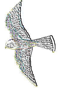
Buzzards, Peregrine and Kestrel can be seen over most of the moorland, with Hen Harrier
and Merlin flying low over the slopes.
Moel Famau Co. Park
O.S.Map Reference SJ160625
Moel Famau or "Mother Mountain" is the highest peak in the Clwydian Range at 555 metres. The
country park is close to Loggerheads Co. Park and
information is available at the visitors centre there. Access is via a minor road
(signposted) off the A494 about 1.5 klometres west of Loggerheads. The park consists of
paths through coniferous woodland and open moorland to the summit of Moel Famau.
The ruins of the "Jubilee Tower" built in 1810 to celebrate the
jubilee of King George III lie at the summit.
World's End/Panorama
O.S.Map Reference SJ232482
The map reference given here is for the car park at World's End. From here it possible
to walk on the Offa's Dyke Path (traditionally the 8th. century defensive border between
England and Wales) on the lower slopes of the Eglwyseg Mountain, to the Panorama which
yields magnificent views over the Vale of Llangollen. From the car park, walk downhill 1/2 Kilometre to a hairpin bend at the bottom of
the valley. To the right, a signpost leads
up into coniferous woodland and through this onto the foothills of Eglwyseg. The Offa's
Dyke path is waymarked from here with Acorn symbols. The Panorama is about 6 Kilometres from
this point. Alternatively, it is possible to drive through the valley and take a signposted
road to the left up to the Panorama. The path contains a number of
habitats including coniferous woodland, open deciduous wood and
scrub, heath and moorland. The number of bird species that can be
found here is reflected in this diversity.
From the car park, walk downhill 1/2 Kilometre to a hairpin bend at the bottom of
the valley. To the right, a signpost leads
up into coniferous woodland and through this onto the foothills of Eglwyseg. The Offa's
Dyke path is waymarked from here with Acorn symbols. The Panorama is about 6 Kilometres from
this point. Alternatively, it is possible to drive through the valley and take a signposted
road to the left up to the Panorama. The path contains a number of
habitats including coniferous woodland, open deciduous wood and
scrub, heath and moorland. The number of bird species that can be
found here is reflected in this diversity.
Llantysilio Mountain
O.S.Map Reference SJ148454
The Llantysilio Mountain rise to the north above the village of Glyndyfrdwy on the A5 and
to the south, above Bryneglwys on the A5104 and may be approached from either direction.
At Glyndyfrdwy, take the road for the Steam Train Railway and continue over the level crossing
and the bridge over the River Dee. Turn left over the bridge and take the next right up a
steep and winding road over the mountain. From Bryneglwys, take the A5104 east. Turn right
at the next junction and take the signposts to Glyndyfrdwy.
This is a short but spectacular journey and at the top given good weather conditions it is
possible to see the Snowdonia Range. There is a good chance of seeing Merlin, Hen
Harrier and Peregrine from this point.
Horseshoe Pass
O.S.Map Reference SJ192482
The "Horseshoe Pass" is a scenic route from Llangollen to Llandegla, between the
Maes Yr Ychen mountain on one side and Eglwyseg mountain and Cyrn y Brain on the other. It does
suffer at peak times of the year from a surfeit of holiday makers, but it is only necessary
to walk a short distance from the road on one of the many footpaths in order to avoid the
crowds. On the A539 about 2Km west of Llangollen, a well signposted road leads up to the pass.
Access from LLandegla is again well signposted off the A525. Most of the expected moorland
birds can be found here including the Chough which is reported in most years.
Pistyll Rhaeadr
O.S.Map Reference
In the Welsh language "Pistyll" means "cascade" and this fall near the village of Llanrhaeadr
Ym Mochnant in the south of the county, is the highest waterfall in Wales and England, at 74
metres. It runs off the Berwyn Mountains and forms the River Rhaeadr which for about 10 Km
along it's length forms the county boundary with Powys. Directions to the fall are well
signposted from the village which is about 4 Km away.
The site has mature mixed woodland, river valley and the moors above. There are footpaths
either side of the falls and up into the moorland. A broad range of birds can be seen here
particularly through the summer months.
Offa's Dyke
A Countryside Commision/ Ordinance Survey Book is obtainable on
walks along the Offa's Dyke path, most of which will also provide
some interest to the birdwatcher. The book is titled "Offa's Dyke
Path North" and is published by Aurum Press ISBN 1-85410-016-5.